Programs Page
The program processes a text file that contains National Marine Electronics Association (NMEA) format GPS data and creates GPS track and waypoint text files which can be imported into the Delorme GPS mapping programs.
The NMEA file must have NMEA.TXT as the last characters of the file name. For example: 2005-JUNE-03_NMEA.TXT
The files created are:
- Track points showing positional data every two seconds.
- Waypoints showing speed every specified interval. Default is 15 degrees (distance).
- Waypoints showing the time at the same interval as the speed waypoints.
- Waypoints showing the number of satelites being used. Same interval as the speed.
- Waypoints showing a 3 if the solution is 3D or a 2 if the solution is 2D. Same interval as the speed.
The program was written to get a better idea of satelite coverage, help explain why sometimes the track would take off in a direction and come back again (wild points due to satelite coverage), see how fast we were traveling through an area and then finally, to mark the times along the track.
The last piece of information, the time, can be used to match up location with pictures. As long as the camera's date and time is syncronized to the GPS data, it is an easy matter to use the picture's creation date and time to locate where the picture was taken.
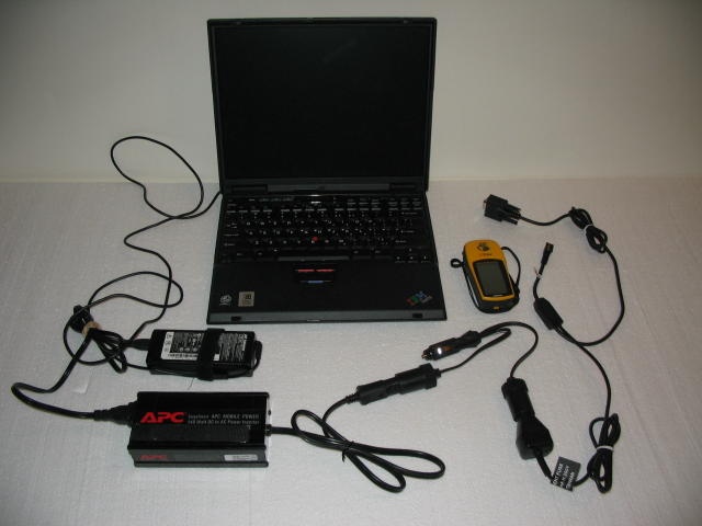
The program was created for and tested on a NMEA text file that was created using the following:
- A Windows 98SE laptop running the HyperTerminal program.
- A Garmin handheld GPS unit velcroed to the dash.
- A car power/data transfer cable to power the GPS unit and to transfer the NMEA data to the Serial port. You must set the interface to NMEA Out.
- A power inverter to convert the car voltage to house voltage so the portable can be plugged in.
The following photos can further explain things.
- Photo of equipment used.
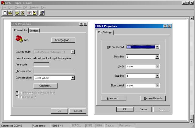
- Photo showing what to set in HyperTerminal.
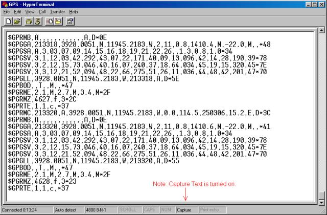
- Photo showing HyperTerminal in use collecting NMEA data.
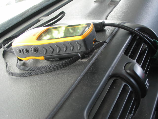
- Photo showing the Garmin GPS unit on the dash.
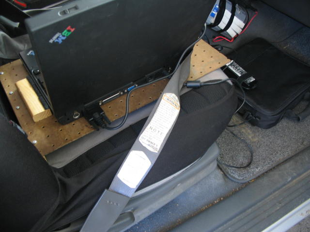
- Photo showing the back side of the portable. Note the seat belt.
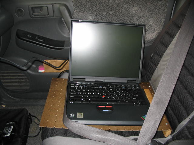
- Photo showing the front side of the portable. Note the seat belt.
NOTE: These programs are provided on an "As Is" basis and the user assumes all liability. It is assumed the people downloading these files are knowledgeable in electronics, computers, and GPS and will be able to figure out things on their own. Support is not included.
